GMU Map Colorado
 Colorado Big-Game GMU Maps
MyTopo Hunt Area / GMU Maps provide the Western US public land hunter with 1:100, 000 Bureau of Land Management base maps with State hunt area or GMU boundaries. The BLM maps include public land ownership boundaries and are a great intermediate-scale resource for scouting hunting areas, planning travel routes, and inspecting the terrain.
New Road Updates for 2013: Select GMU maps now contain updated 2013 National Forest and public land roads sourced directly from the US Forest Service and other government agencies.
Colorado GMU Maps »
 Colorado USGS Quad Topo Maps
Browse for USGS Quad Topo Maps.
USGS Quad Topo Maps »
Custom Colorado Topographic Maps
MyTopo Topo Maps are made from the original US Geological Survey topographic maps: the standard for detailed topo maps in the United States.
Custom Topo Maps »
2010 Colorado Color Aerial Photos
Statewide Colorado coverage of 2010 color aerials. The photos are 1-meter ground resolution and provide a natural color satellite/aerial view for the best possible detail.
Custom Aerial Maps »
TopoPhoto Aerial Photo/Topographic Map Hybrids
We've combined the best in color aerial photos with the USGS topographic maps... together in one map product.
Custom Hybrid Maps »
Colorado Lake Maps
Add lake depth contours to any custom map and aerial photo. We have 15 lake depth maps available in Colorado.


You might also like
![Game Warden Honor Guard - Texas Parks and Wildlife [Official]](/img/video/game_warden_honor_guard_texas.jpg)

|
Find It Wildlife Game Toy (Publisher Services Inc (PSI))
|
|
Annke C301 720P Digital Game Cam Trail Camera (IP56 Waterproof Hunting Wildlife Monitoring Camera with 48 pcs of no-glow IR 940nm LED, No SD card) Sports (Annke)
|


|
Bestok 8210A-C 12MP Digital Infrared Night Vision Outdoor Waterproof Wildlife Cam Scouting Stealth Trail Hunting Game Spy Camera Security Wide Angle + 4G SD Card Sports (Bestok)
|
|

|
Deadly killer Raptor Revenge Mobile Application (3D Gamax Games)
|
|
Educational Trivia Card Game - Professor Noggin's Wildlife of North America Toy (Outset Media)
|


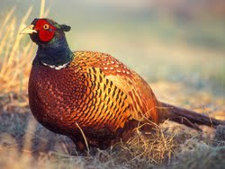 Game is any animal hunted for food or not normally domesticated. Game animals are also hunted for sport.